
Section 2: Peebles To Cardrona
Explore natural wonders and a site of outstanding biodiversity along this gentle, four-mile stretch.
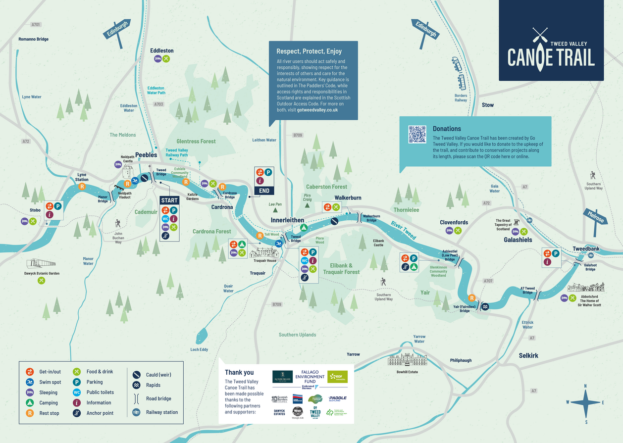
Section 2: Need to know
Distance/time: approx. 4 miles/1.5 hours
River Grading: Level 1
Start point: what3words: scrubber.lion.revision
End point: what3words: bungalows.bolsters.dressing
Facilities: Refresh and refuel at Macdonald Cardrona Hotel – a short drive from Woodend car park or easy walk from the rest stop marked on the map.
Public transport: Borders Buses operates a regular service between Peebles and Cardrona (X62).
Section snapshot
Leaving Peebles via Tweed Green and the lofty spire of St Andrew’s Leckie Parish church, the river passes beneath Priorsford Bridge, an ornate, late-Victorian footbridge that connects the town’s residents north and south of the water.
If time permits, take a break to explore Eshiels Community Woodland, a site of outstanding biodiversity along the riverbank opposite Kailzie Estate. And keep watch for buzzards (and mountain bikers!) taking to the air around Glentress Forest – visible on the hillside beyond the ruins of Horsburgh Castle (river left).
A distinctive, iron bridge – also known as Horsburgh Viaduct – marks the approach to the village of Cardrona. Once part of the Peebles to Galashiels branch of the North British Railway, the viaduct is now used by walkers and cyclists travelling to and from Cardrona Forest, along with golfers playing on Macdonald Cardrona’s championship course.
A double bend in the river beyond the bridges brings Section 2 of the canoe trail to a close. When the river is up, a separate channel can form here to the right – ignore and carry on straight. Look out for the wooden way marker below Woodend car park (river left) that identifies the official get-out point at the end of this stretch of river.

Paddlers beneath Cardrona Bridge
Image credits: Ian Linton Photography; Biggar Adventure